| |
The History of The Mill Pool Woods
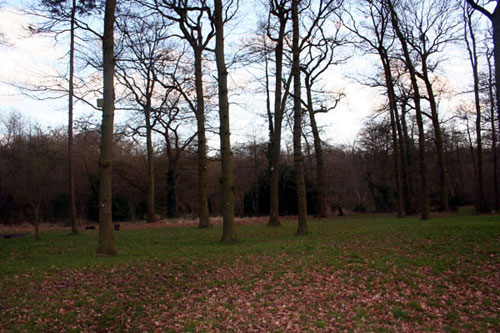 |
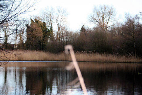
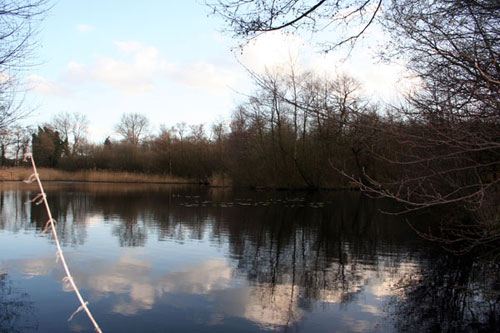
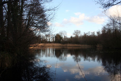
At the far end of the woods you will find in the mud and rhododendrons, the remains of a very large circular pool with an island in the centre. Next to this is an enormous dyke, still around 10ft high, and beyond that, next to the golf course, the shallow traces of several small ponds. No one knows for certain what this was and there are no written records. However, since the excavations at Hobs Moat have now proved the existence there of the original manor house built by Hugh de Odensil, Lord of the Manor of Solihull in Saxon and Norman times, it is highly possible that this was the site for the “Dom Muhle” the Lord’s mill where all the Lord’s tenants would have been forced to bring their corn, paying highly for the privilege of having it ground into flour. The only possible reason for the dyke seems to be as a dam for the pool. It is however, a mystery why it is so enormous. The island in the pool was to keep the ducks, which were a valuable source of winter food safe from predators, and the shallow pools would have been well stocked with perch and roach for the Lord’s use. |
 |
Mills in the middle ages were a profitable source of income for the Lord of the Manor as everyone on his estate was compelled to bring their corn to him to be ground into flour for their bread, and to pay handsomely for the privilege. The records for this period contain numerous references to men being fined for grinding their own flour and of millers being fined for charging excessive tolls. |
 |
Frustratingly, there are numerous Court Rolls for Knowle, and none for Solihull. So all we have to go on are the extensive and impressive remains at the top of the spinney, on what is now land belonging to Olton Golf Club. Running parallel to the broken down fence, which marks the boundary of 1st Solihull land is the “Occupation Road”. It can hardly be a coincidence that this runs straight as an arrow from the mount at Hob’s Moat to the spire of the Saxon foundation of St. Alphege in Solihull. There is no evidence of any connection between the two, but it is obvious that this road was used by farmers on Dovehouse Lane and Olton to take their produce to Solihull and beyond. This was no minor “greenway” track; it was a well made, broad, metalled road. Lost in the wood are several shallow depressions, which are thought to have been marl pools. Marl was used both as a fertiliser on the fields and for brick making. |
 |
So we move onto the sixteenth century, by which time there was a mill in operation at the Lode Lane end of the site. There appears to be no records of when, or by whom, the present Mill Pool was constructed. The earliest record that has been traced so far is for the period when it was owned by the Palmer family. For several generations the Palmers, who probably lived at the Olton Hall, owned most of the land in “Olton Ende”. George Palmer died in 1686. In his will he decreed that some of the profits from the mill should be given to the poor of the parish of Solihull. As an example, the Parish Book records in 1706 “four poore householders, men or widdowes chosen by Mr. Benjamin Palmer Esq. To have Mr. George Palmer’s dole of 20 shillings issueing out of the Mill upon Lewd (sic) heath for the year 1706”. Twenty shillings would have been a considerable sum at today’s reckoning, but we do not know if this was a profit from the mill or rent paid by a tenant miller. In 1751, when the land tax stood at 3/- in the £1, the Palmers still owned most of Olton. In that year “B.Palmer Esq.” Paid 11/1d “for the mill”, and the following year he paid 16/71/2d. Out of interest, in 1755, Benjamin paid a grand total of £102.5s.4d in land tax. £88.1s.10d more than anyone else in the Ende of Olton. |
 |
It was not until the middle of the nineteenth century that the names of individual millers appear in the Rates Records. Then there was a succession of men and women – Mr.W.Vere in 1842, George Hodges in 1876 and his widow who tried to run the mill for four years until it passed to Walter Smith. In 1858 the Mill Pool was part of a much larger estate of approximately 200 acres, ten times the present size, and was owned by the Alston family. It was in two parts, Row Wood Farm which included part of Billsmore Wood, a homestead, two cottages, several pastures and fields etc. totalling 176 acres. The second part was known as Olton Mill Farm, 25 acres, which comprised a house and outbuildings, the Mill Pool spinney and certain pools and islands. The mill was presumably included in the outbuildings of Olton Farm. |
 |
One particular strip of land of 2.788 acres formed what seems to be a track or route between arable fields from roughly where the Land Rover sports ground now stands, off Rowood Drive, to somewhere beyond the main entrance to the Land Rover factory itself. This strip ran in an almost straight line on the other side of the canal. This unusual shaped piece of land was known, and is referred to on the old map as: - Foredrove. No doubt Foredrove Lane on the estate owes its name to this but how did one of our Scout Troops become named after it? |
 |
Easements were granted which allowed a right of way at all times with or without horses or other animals, carts, carriages or other vehicles between Olton Mill Farm and “Dovehouse Road” by means of the route known as Occupation Road. It is at this point that the writer believes that the reader is possibly getting rather confused!
Olton Mill Farm stood between Lode Lane, Rowood Drive and the canal – roughly square and opposite the Lode Heath School end of the present pool. Thus water from the pool for the mill did not flow through the present culvert, although one was there at the time, but through another half way along the pool. Somewhere near our boundary with the school was a spring and easements were granted for rights of access to the pipe, which supplied domestic water to the mill house. There was also a well and hand pump, which stood near the bridge over the canal in Dovehouse Lane. Henley and Rowlands Crescent stand on what used to be arable land, whilst our present front lawn and HQ building was a pool.
|
 |
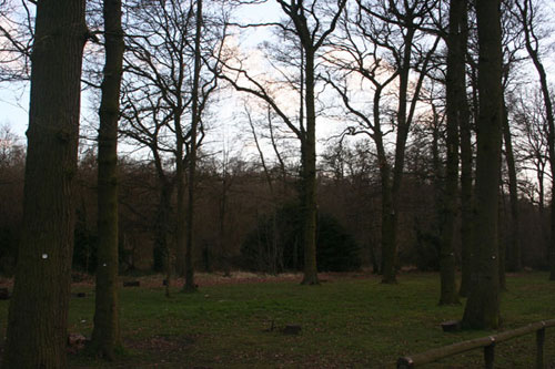
In 1918 the property was still in ownership of an Alston, but in 1921 the family sold the whole property to Fred Platt, an engineer from Solihull for £8016. When he died shortly after the sale, the woods were bought for only £6550 by James Newey of St. Bernards Road, the hook and eye manufacturer, who planted a lot of young trees as he wanted the land for light shooting. This explains why, although there are some fully matured trees, many of them are so spindly as the wood was never thinned. About this time, the mill fell into disuse and the buildings were used by J. H. Bourne & Sons as a storehouse for their seed shop in Solihull High Street. The house was inhabited by the Coton family, until it was pulled down when the new houses were built.
|
|
It seems that the once large estate was now about to be broken up, for in 1925, James Newey sold Olton Mill Pool and Spinney, 18 acres, to Edward Evans, a jeweller from Birmingham for £550. Now, as this represents our present site, no further title deeds are available to us for inspection therefore, what remained of the estate and how it developed or otherwise is unknown. However, we can continue to see how the Mill Pool changed. Several official searches were made in 1937 and it is interesting to note that the Mill Pool was in Warwick County and the planners at the time, Solihull & District Executive Joint Planning Committee who met at the Shire Hall, Warwick, would not allow the building of houses on the land as it was designated a public open space. Perhaps, due to the fact that the planning permission was refused, Mr. Evans sold the site in September 1937 for £950 to the Rev. Reginald Couchman, the purchaser, and three further members of the Couchman family, two of whom were “clerks of holy orders” and the third a Doctor, the Trustees. One wonders why the Couchman family purchased the site as none of them lived near Solihull. The Olton Mill continues to be shown on the plans as does the Occupation Road, but were they in use or disuse?
|
 |
In 1941, Warwickshire County Council wished to widen the Solihull – Sheldon County Road and needed to acquire .453 acres. This they did for a sum of £100 plus fees and Lode Lane became the road we know it as today. Sometime between 1930 and 1940, an easement was granted to allow a foul sewer to be taken across the golf course and then Mill Pool Woods. No records exist of this in the deeds but the sewer, which serves Buryfield Road, Links Drive and so on has been inspected in the past 10 years and drawings provided by SMBC. The sewer terminates in Lode Lane close to our drive.
Further official searches were made in 1947 and records show that W. Maurice Mell (Mell Square) was clerk and solicitor to the council, the Solihull Urban District Council residing at the Council House, Solihull. In a document entitled “Observations Before Contract”, a question is asked by the purchasers’ solicitor: - “Has the Mill owner any rights in connection with the Mill Pool”. The reply by the vendors’ solicitors suggests not, but was the mill still there in 1947?
|
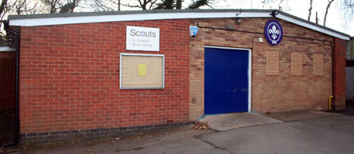
The Rev. Couchman died in 1948 and the property passed to Dr. Hugh Couchman, and shortly after, in 1950, he sold the property to the trustees of the 1st Solihull Group of Boy Scouts. For this transaction, past members of the group, the present and the future will be eternally grateful. Can we really appreciate how fortunate we are? One of the original trustees, Mr. Ian Hall, continues to maintain close contact with the group from his home in Dorset, and long may that continue, supported by others who have been appointed as time has moved on.
The old bridge, allegedly 13th century, which carried the traffic of the day to St. Alphege Church, has unfortunately had to be dismantled due to partial collapse. One of our beautiful trees is reputedly at least 300 years old, what mysteries does it hold? We have adopted the mill wheel as part of our Group emblem but we all wonder what the mill and the wheel really looked like.
Compiled by Betty Simmonds & Terry Harrison.
March 1986 – revised June 1998.
|
| |
|
|
|
|
| |
|
|
|